Introduction
Communities face significant challenges when dealing with natural disasters. The losses incurred, such as human lives, property, economic stability, and environmental damage, often exceed what a population can handle on its own. Over the past 25 years, the frequency, intensity, and unpredictability of these catastrophic events have increased noticeably.
To minimize the impacts and save lives, disaster management has become a crucial area of study and practice. Space technology is proving to be an invaluable tool in supporting disaster management efforts, as it enables more efficient response and recovery strategies to be developed and implemented.
Satellites: A Powerful Tool for Earthquake Response
Satellites play a crucial role in earthquake recovery efforts by enabling the mapping of damage through high-resolution cameras. They also facilitate communication and navigation with aid workers, allowing for more effective coordination of supply deliveries. Additionally, satellites provide a supplementary help in environmental monitoring, to mitigate potential secondary disasters such as landslides or floods.
Among the different instruments, the Chinese Seismo Electromagnetic Satellite (CSES) is a critical tool in understanding the relationship between the environment and earthquakes. Launched in 2018 through a collaboration between the Chinese Space Agency (CNSA) and the Italian Space Agency (ASI) from the Jiuquan base in the Gobi Desert, the CSES is designed to investigate potential correlations between ionospheric perturbations and earthquakes. Its mission is to enhance earthquake predictability and contribute to the development of early warning systems, which could save countless lives and mitigate the impact of future seismic events.

|
Illustration of a satellite used to detect ground movements |
One of the striking examples illustrating how satellites can contribute to disaster management is the reaction to the 7.8 Mw earthquake which stroke Turkey and Syria earlier this year. According to the current estimates, this catastrophe caused around 50.000 deaths. During this terrible episode, satellites have been crucial to contribute to the emergency response. Thanks to the collaboration of 17 different space agencies about 350 crisis images were delivered, “Copernicus Emergency Mapping Service” was activated, and satellites “Sentinel 1” and “Sentinel 2” were used to detect displacements.
NASA Analysis used to analyse the earthquake in Turkey

Space: A Key Instrument For Environmental Management
In the previous parts we have highlighted the importance of satellites in disaster management. However, environmental applications of space technologies are not limited to emergency response and remediation; satellites are also used for long term planning and resources management. Among the different space agencies working on this strategic matter, NASA is one of the most advanced. The agency has developed several programs to monitor the use of natural resources and improve food security such as SMAP, Landasat and MoM.
First, the SMAP program (Soil Moisture Active Passive) aims at measuring soil moisture levels on a global scale. By combining data from its instruments, SMAP can create high-resolution maps of soil moisture, which are updated every two to three days. Although this program may not appear to be essential at the first glance, the SPAM presents numerous benefits and provides many strategic advantages. In fact, accurate measurements of soil moisture are crucial for understanding the water cycle and predicting weather patterns, as well as for managing water resources and predicting crop yields. SMAP data can also be used to monitor droughts and floods, and to improve weather forecasting models. However, the main benefit of SMAP we want to focus on is how measurements can be used by farmers in replacement of multiple expensive ground-based sensors. This allows them to predict crop yields and make necessary adjustments. Overall, SMAP is an important tool for improving our understanding of the Earth system and for making informed decisions about how to manage our natural resources.
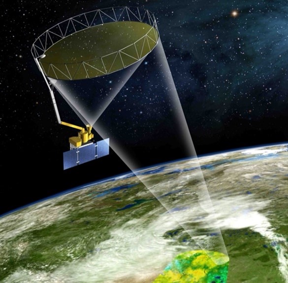
Illustration of Smap’s technology
Second, we would like to highlight is Landasat: one of NASA’s longest-running missions, comprising nine Earth-observation satellites. These satellites have been providing high-resolution images of the Earth’s surface since 1972. The Landsat program has been instrumental in monitoring changes in land use, such as deforestation, urbanization, and agriculture, as well as in mapping natural disasters, monitoring water resources, and studying climate change. The Landsat satellites carry sensors that capture different data that allow for the creation of detailed images that can be used for a wide range of applications. Satellite imagery is freely available and widely used by scientists, land managers, and policymakers around the world. Landsat data has also been used to study the effects of climate change on the Earth’s surface, including changes in ice cover, sea level, and vegetation patterns.
Finally, the last program that raised our attention is MoM (Model of Models), an open-source flood early warning system. This network developed in collaboration with disasterAWARE works by aggregating multiple data sources and creating a comprehensive risk score for each region. If a significant risk is presumed, disasterAWARE sends warnings to both authorities and people who have signed up for the free program. This technology is already used by many communities and helps protect especially those in a vulnerable position whose governments have inadequate response measures.
Planetary Defense: Risk evaluation and Mitigation Strategies
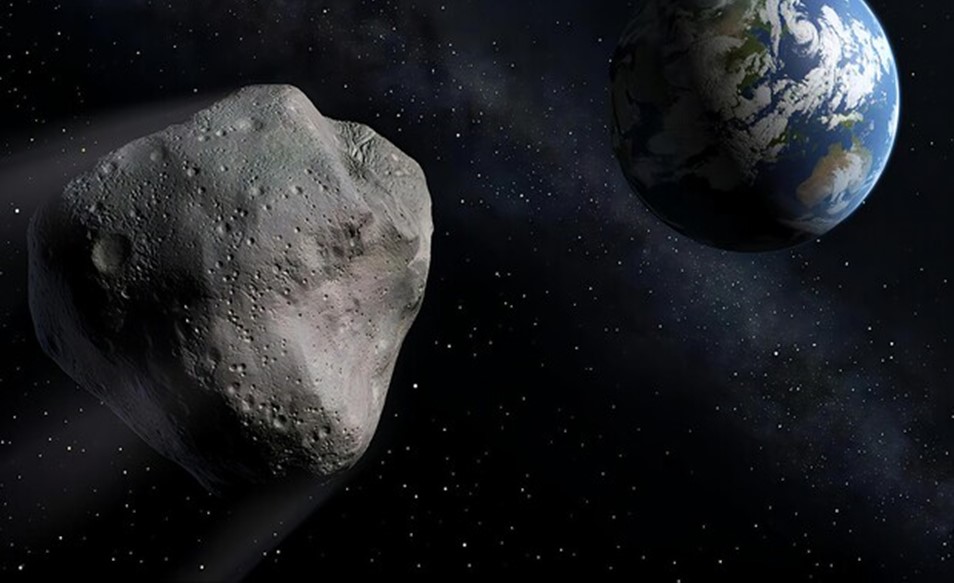
In addition to earthquake response and environmental management, one of the fields in which space technologies provide an important contribution is planetary defense. Since asteroids represent a significant risk for life on Earth, implementing efficient mitigation strategies is crucial. About 66 million years ago, a mountain-sized asteroid, with an estimated diameter of 10 to 15 km, hit the Earth off the coast of Mexico’s Yucatán Peninsula with high velocity and effectively vaporized, releasing energy equivalent to billions of atomic bombs. The impact led to the extinction of around 75% of Earth’s animals, including dinosaurs. For this reason, planetary defense against space rocks and the various tools and techniques that we have at our disposal to prevent their collision with Earth is an extremely relevant subject.
In order to effictively fight asteroids and deploy defense technics, it is first crucial to identify and seize the risks of collision. While the principles dictating gravitational forces have been established for a considerable period, the exercise is particularly difficult for asteroids. The primary challenge lies in obtaining asteroid data with sufficient accuracy, particularly with respect to distance and velocity. Fortunately, in the majority of instances, celestial bodies that enter the Earth’s atmosphere are relatively small and land in the ocean, thereby causing no harm. This is largely attributed to the fact that over 70% of the planet’s surface is covered by water. However, in the event that such a body does crash on land, it begs the question: what are the available options?
Currently, scientists have devised various planetary defense techniques, with numerous others still undergoing testing. However, it is crucial to acknowledge that selecting the most suitable method is contingent upon two primary factors: the physical attributes of the asteroid, as well as the time remaining at impact.
The main three proven techniques are: nuclear explosion, the kinetic impactor and the gravity tractor. The utilization of the nuclear explosion technique is particularly advantageous in situations where limited notice is provided. Upon detonation at a specified distance from the space rock, an array of x-rays and neutrons are released, which subsequently hit the asteroid and push it in the opposite direction. Alternatively, the kinetic impactor method involves colliding a high-speed probe (traveling at a few km/s) with the astronomical target, to provide it with a necessary boost. Notably, the first experiment of orbital deflection using this technique was executed via the NASA DART probe, which impacted the asteroid Dimorphos, thereby successfully altering its orbital velocity. Lastly, the gravity tractor approach involves the use of a spacecraft’s gravitational pull to tow a space rock onto a safe course, without any physical contact between the two entities.
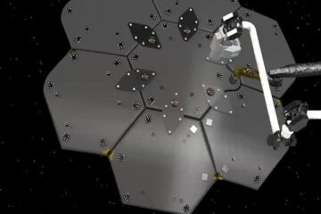
Illustration of the Spray-painting technique
Recent advances in asteroid deflection strategies include the utilization of new techniques such as the ion beam method, whereby a spacecraft projects a beam of collided ions onto the asteroid, and the laser ablation technique, which involves the use of one or more monochrome lasers to vaporize surface material of the space rock. Additionally, a particularly intriguing approach is the spray-painting technique, which entails wrapping the asteroid with plastic films or applying light or dark paints to increase its ability to reflect or absorb sunlight, ultimately inducing changes in its orbital trajectory. However, it is important to note that any alterations to the asteroid’s orbit may be beyond our control.
Finally, it is imperative to underscore that while these techniques hold promise, they are not without limitations. Therefore, it is crucial to engage in rigorous activities of spatial surveillance and physical characterization of minor bodies of the solar system. Such efforts are essential to enhance our understanding and alertness in mitigating potentially devastating impacts from space objects.
Authors: Chiara Nespoli, Barbara Kanowsca, Leopoldo Schiavi and Luis Pericchi

0 Comments